Superimposing 1945 images from the National Archives of Singapore (NAS) with Google Earth Maps of 2022. This 1945 topographical map of Singapore island is one of the rare few produced by Indian military surveyors following the return of the British to Singapore after the Japanese surrender. The map’s distinctive color schemes, with areas of farmland marked in bright yellow, followed the survey of India's standard colors.
Überlagerung von Bildern aus dem Jahr 1945 aus den National Archives of Singapore (NAS) mit Google Earth Maps von 2022. Diese topografische Karte der Insel Singapur aus dem Jahr 1945 ist eine der wenigen, die von indischen Militärvermessern nach der Rückkehr der Briten nach Singapur nach der japanischen Kapitulation erstellt wurden. Die charakteristischen Farbschemata der Karte mit hellgelb markierten Ackerlandflächen folgten der Übersicht über die Standardfarben Indiens.
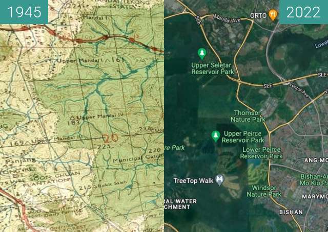
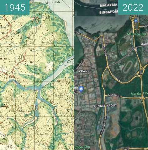