Superimposing 1945 images from the National Archives of Singapore (NAS) with Google Earth Maps of 2022. This 1945 topographical map of Singapore island is one of the rare few produced by Indian military surveyors following the return of the British to Singapore after the Japanese surrender. The map’s distinctive color schemes, with areas of farmland marked in bright yellow, followed the survey of India's standard colors.
Superposition d'images de 1945 des Archives nationales de Singapour (NAS) avec Google Earth Maps de 2022. Cette carte topographique de l'île de Singapour de 1945 est l'une des rares produites par des géomètres militaires indiens après le retour des Britanniques à Singapour après la capitulation japonaise. Les schémas de couleurs distinctifs de la carte, avec des zones de terres agricoles marquées en jaune vif, ont suivi l'enquête sur les couleurs standard de l'Inde.
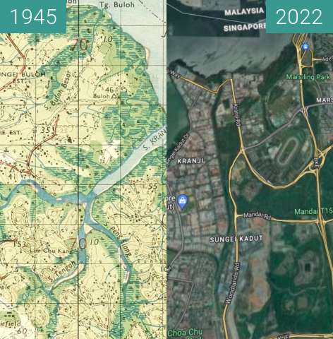
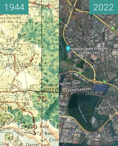