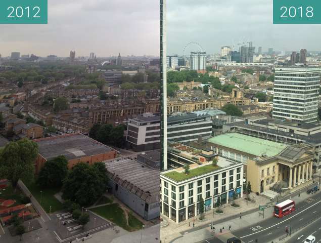
Awesome! Just the location seems to be incorrect
Impressionnant! Juste l'emplacement semble être incorrect
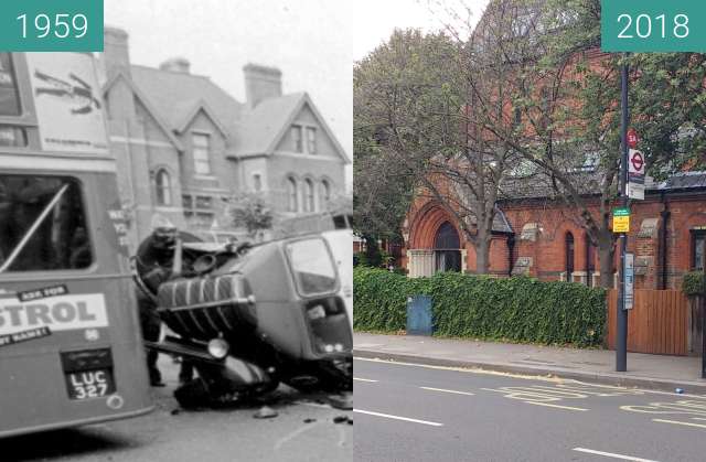
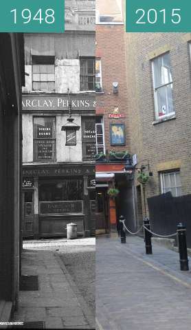
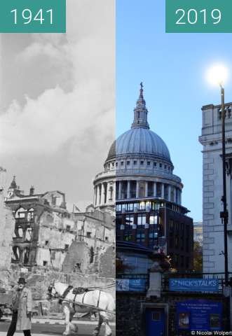
@nwolpert it is the right location look at the church on the far right, its just a lot of the building have been destroyed over the past 100 years and the pavement has changed.
@nwolpert c'est le bon endroit, regardez l'église à l'extrême droite, juste une grande partie du bâtiment a été détruite au cours des 100 dernières années et le trottoir a changé.
I meant in the map actually (the marker is set at Trafalgar square)
Je voulais dire sur la carte en fait (le marqueur est placé sur la place Trafalgar)
@nwolpert Ah sorry
@nwolpert Ah désolé
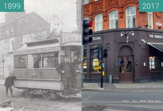
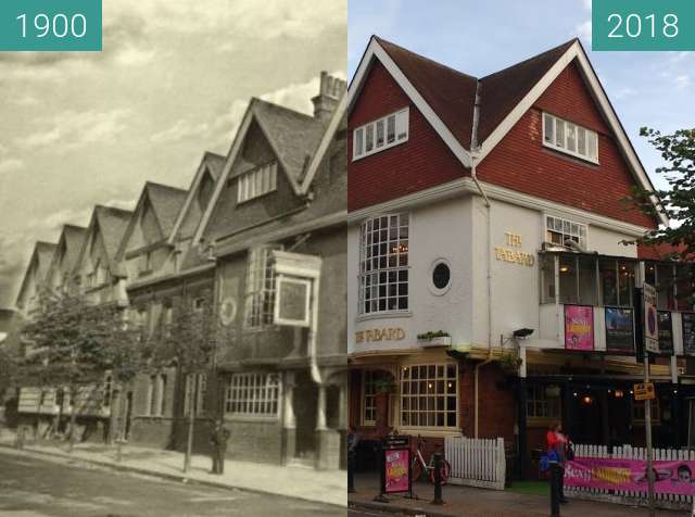
Great. Pubs always seem to be a great landmark
Génial. Les pubs semblent toujours être un grand point de repère
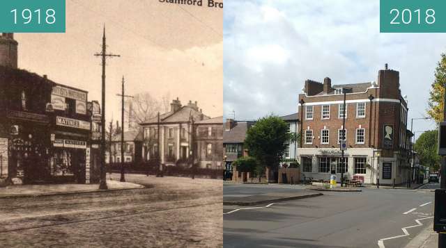
The name may be a corruption of 'stoney ford' or 'sandy ford' by which it was crossed by King Street. Stamford Brook has given its name to the surrounding area between Hammersmith and Chiswick and to local London Underground station, Stamford Brook.
The county of London formed in 1889 was bounded by the westernmost course of Stamford Brook, forming the boundary separating London Boroughs of Hammersmith and Acton in the new county from the Chiswick and Brentford Urban Districts in Middlesex.[1]
By 1900, all six strands of the brook and drainage dykes had been covered over and formed the most useful depressions available in which to site the neighbourhood's sewers, many diversionary surface water drains had been created closer to the surface to drain the catchment basin.[2]
Le nom peut être une corruption de «gué de pierre» ou de «gué de sable» par laquelle il a été traversé par King Street. Stamford Brook a donné son nom à la zone environnante entre Hammersmith et Chiswick et à la station de métro de Londres, Stamford Brook.
Le comté de Londres formé en 1889 était délimité par le cours le plus à l'ouest du ruisseau Stamford, formant la frontière séparant les arrondissements londoniens de Hammersmith et Acton dans le nouveau comté des districts urbains de Chiswick et Brentford à Middlesex. [1]
En 1900, les six volets du ruisseau et des digues de drainage avaient été recouverts et constituaient les dépressions les plus utiles disponibles pour l'emplacement des égouts du quartier, de nombreux drains de dérivation des eaux de surface avaient été créés plus près de la surface pour drainer le bassin versant. [ 2]